The Places
The name is written into the map of west Donegal. Explore the territories, placenames and sites linked to it, period by period.
Was there an Ó Baoighill territory?
Yes. The Annals call an Ó Baoighill chief of the Three Tuaths from 1247 to 1360, and “chief of Tir-Ainmirech” in 1343. From 1530 there is a “Tanist of Boylagh”: the name of the barony.2,3
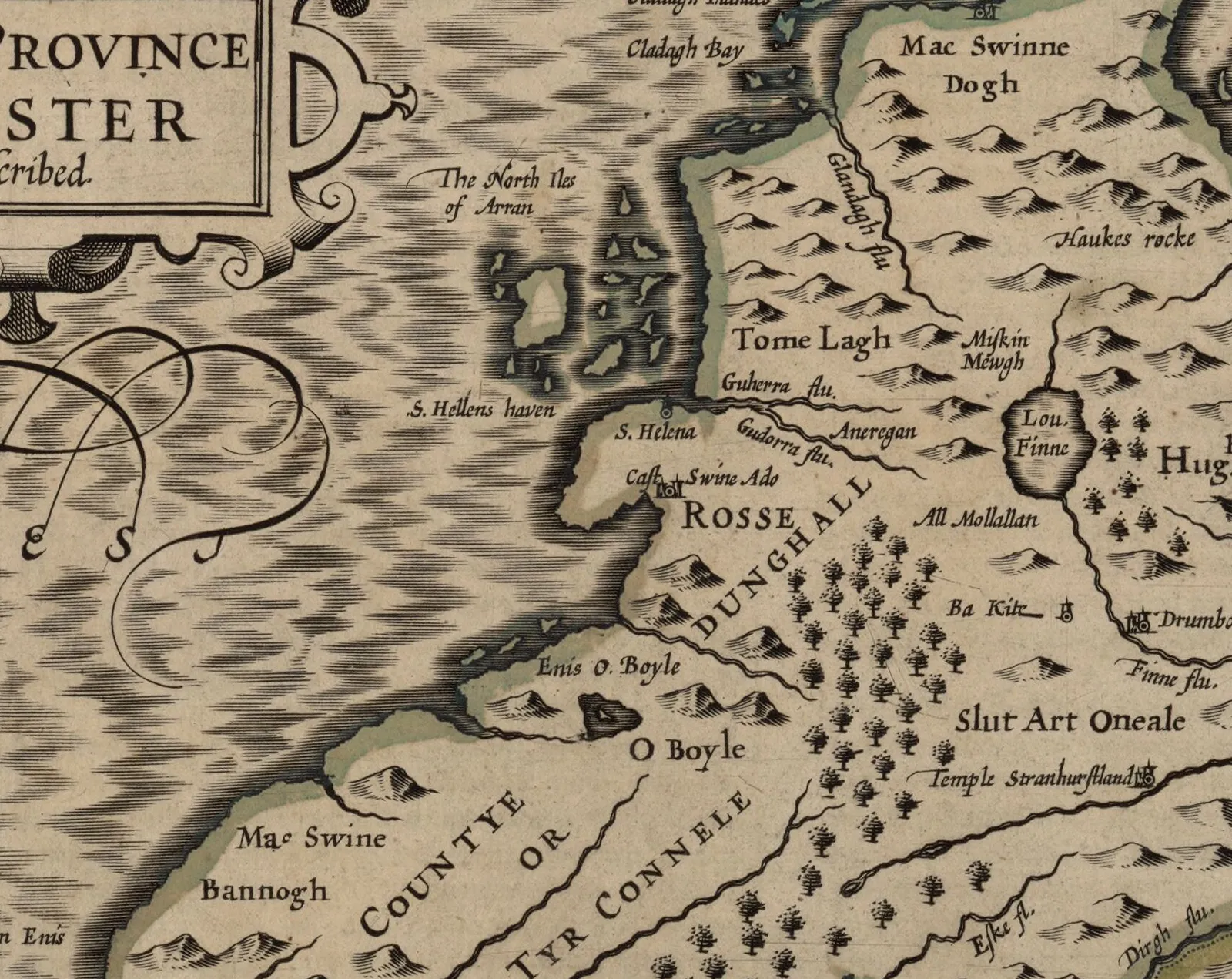
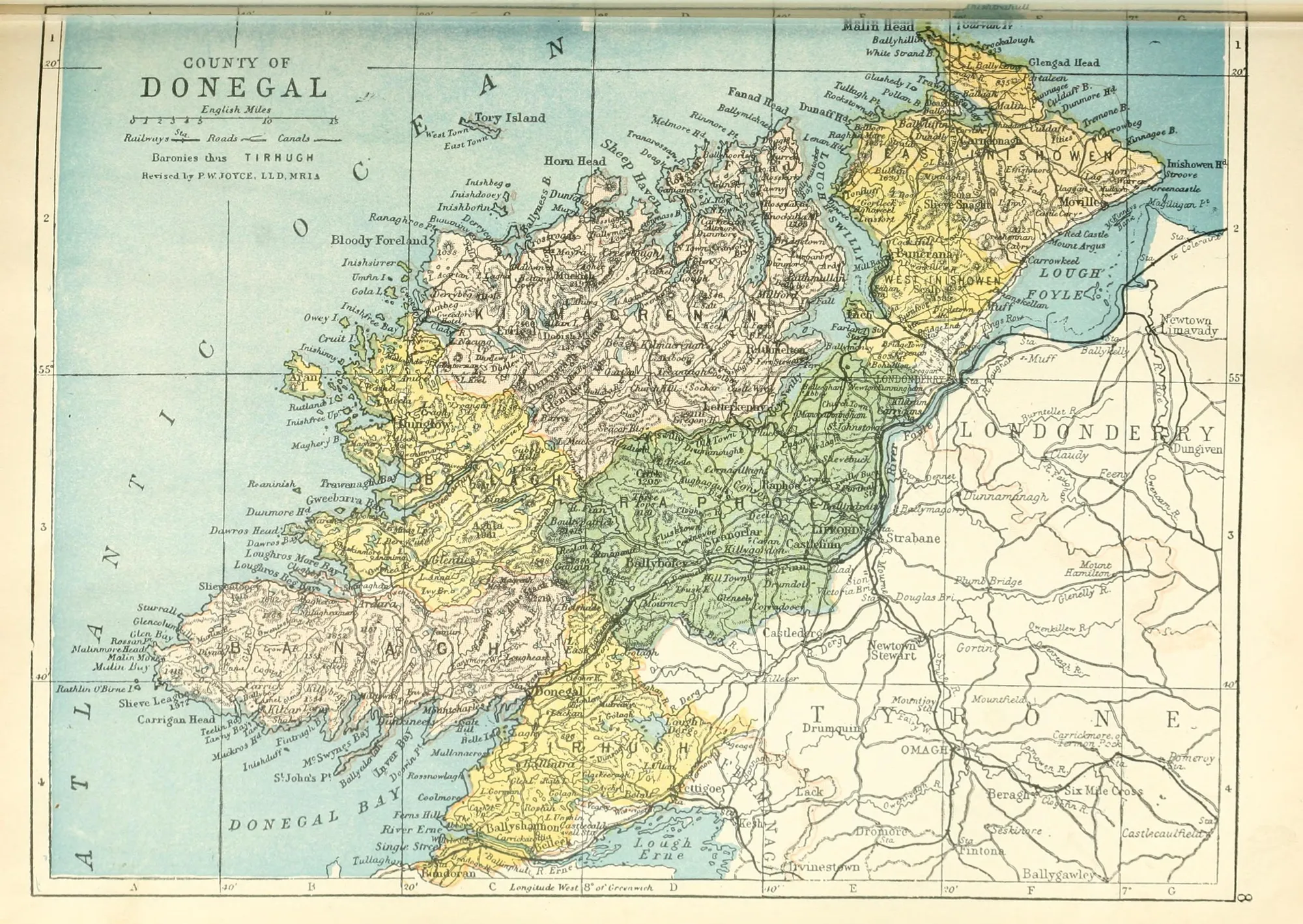
That western territory was known as Críoch Bhaoigheallach, “O’Boyle’s country”, a name that survives, much changed, in the barony of Boylagh (Baollaigh). Joyce likewise derives the barony’s name from the territory of the O’Boyles.18,21,22
Read more
Woulfe and O’Donovan say the O’Boyles moved from the Three Tuaths to Tír Ainmhireach when the MacSweeneys came. The Annals do not record when or how that happened, and “MacSweeney of the Tuaths” is not named until about 1540. The bounds of these territories are not established; the map shows only general areas.18,44,3Scholarly interpretation
What is Croich Uí Bhaoill?
Near Dungloe, in the parish of Templecrone, a townland and a mountain are called Croich Uí Bhaoill (Crohyboyle), which logainm.ie explains as “the gallows of Ó Baoill”.1
Read more
A record of 1641 gives it as Myntro-iboill, and John O’Donovan wrote it as Croich Uí Bhaoighill for the Ordnance Survey in 1835. Séamus Ó Grianna mentions “sliabh Chroch Uí Bhaoighill” in An Clár is an Fhoireann (1955). Why the place was named for a gallows is not recorded.1
The novelist Tadhg Ó Rabhartaigh (1909–1982), author of Mian na Marbh, was born at Croich Uí Bhaoill.31
Every place on the map
Territories (approximate), approximate
Boylagh / Críoch Bhaoigheallach
The barony of Boylagh, named after the territory of the Uí Bhaoighill. Woulfe says the territory was known as Críoch Bhaoigheallach, ‘O’Boyle’s country’. The Annals name a ‘Tanist of Boylagh’ in 1530. The marker is a label position, not a boundary.18,21,3,41
Territories (approximate), approximate
The Three Tuaths
The Annals call an Ó Baoighill chief of the Three Tuaths between 1247 and 1360. O’Donovan places them in the north-west of the barony of Kilmacrenan. Their exact location is not established; the marker shows only a general area.2,44,18
Territories (approximate), approximate
Tír Ainmhireach
Aindiles Ó Baoighill, ‘chief of Tir-Ainmirech’, was killed at the battle of Achadh Mona in 1343, according to the Annals. O’Donovan took Tír Ainmhireach to be the old name of the barony of Boylagh. Its bounds are not established; the marker is approximate.2,44,18
Placenames
Croich Uí Bhaoill (Crohyboyle)
A townland and mountain near Dungloe. logainm.ie explains the name as ‘the gallows of Ó Baoill’. Recorded as Myntro-iboill in 1641 and as Croich Uí Bhaoighill by O’Donovan in 1835. The marker is the townland centre point given by logainm.ie.1
Documented places
Ballyboyle Castle (Baile Uí Bhaoighill)
Site of the O’Boyle castle on the north shore of Donegal Bay, facing the O’Donnell seat. The Annals mention it in 1440, 1592 and 1607; in 1601 it was called “O’Boyle’s chief house”. In 1611 a house was built from its ruins. No trace is visible today. It lies outside Boylagh, in Banagh.10,4,45,13
Documented places
Kiltooris
A castle in Boylagh. In 1601 Bishop O’Boyle was living here, according to state papers cited by the National Monuments Service.46
Documented places
Faugher (An Fhothair)
Under the Plantation of Ulster the O’Boyle heir was moved out of Boylagh: Tirlagh Roe O’Boyle received about 2,000 acres in Kilmacrenan in 1611, and by 1619 had built a bawn and a stone house here. The lands were forfeited after 1641.47,49
Context
Doon Fort
A stone ring-fort known locally as ‘The Bawan’, ‘Doon Fort’ or ‘O Boyle’s Fort’. The monuments record does not say it was an O’Boyle seat; the link is a name only.48
Placenames
Mullantiboyle (Mullán Tí Uí Bhaoill)
A townland in Killybegs Lower. In 1835 O’Donovan explained “Mullan Toighe Bhuighill” as “hill-top of Boyle’s house”.9
Placenames
Oileán Uí Bhaoill (Boyle’s Island)
An island in Tullaghobegly, as recorded by logainm.ie.14
Placenames
Ailt Uí Bhaoill (Altanyweel)
A minor feature in the Tullaghobegly Gaeltacht; the English form Altanyweel shows the local -yweel sound.15
Placenames
Mín Uí Bhaoill
A sub-townland at Crolly, as recorded by logainm.ie.16
Documented places
Inishkeel (Inis Caoil)
A tidal island in Gweebarra Bay with an early monastic site. According to the Annals, Niall Ó Baoighill, Bishop of Raphoe, was buried here in 1611.4,22,25
Context
Donegal Town (Dún na nGall)
The centre of O’Donnell power. According to the Annals, Turlough Roe Ó Baoighill was buried at Donegal ‘in the burial-place of his ancestors’ in 1591, and Tadhg Óg Ó Baoighill there in 1607.4,20
Context, approximate
The Rosses (Na Rosa)
In the censuses of 1901–1926 the name was densest in the Rosses and Gweedore, led by Annagary, Rutland and Magheraclogher. The marker shows the district in general.22,57
Old maps
No historic map has been georeferenced for this site, so old maps are shown as images in Historical Records instead of being laid over the modern map. Records